拍品 89
Mouzon's Map of the Carolinas
London, 1794
已结束2020年6月18日
成交价
USD 6,000
更多信息
Mouzon's Map of the Carolinas
London, 1794
MOUZON, Henry (1741-1807). An Accurate Map of North and South Carolina with their Indian Frontiers. London: Laurie & Whittle, 1794.
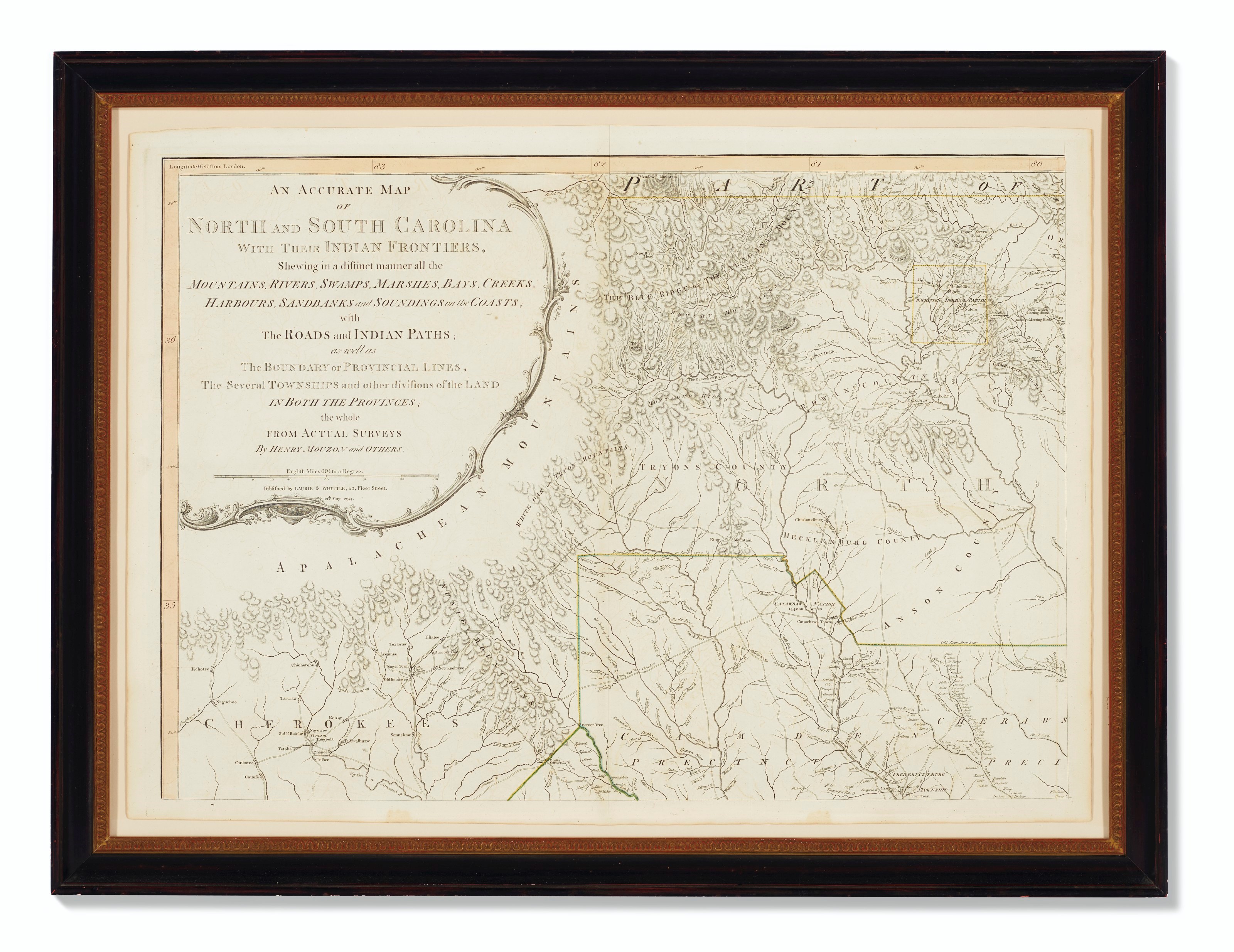
One of the most important maps of the Carolinas, with contemporary outline hand-coloring. The map originally "appeared on the eve of the American Revolution, and its up-to-date geography made it the most widely consulted map of the area used in the war effort" (Pritchard & Taliaferro). George Washington’s copy of the original 1775-76 issue, folded and mounted on cloth, resides in the collection of the American Geographical Society. The map exists in three states, of which the present copy represents the third state, with the original Sayer and Bennett imprint erased and altered to "Laurie & Whittle, 53, Fleet Street, 12th May 1794." Cumming, Southeast in Early Maps 450; Pritchard & Taliaferro, Degrees of Latitude 44; Schwartz & Ehrenberg, Mapping of America p. 187; Sellers & Van Ee, Maps & Charts of North America p. 298.
Hand-colored engraved map on four sheets, each approx. 708 x 501mm on 750 x 545mm sheets, with outline hand-coloring (occasional light toning). Sheets matted and framed separately.
London, 1794
MOUZON, Henry (1741-1807). An Accurate Map of North and South Carolina with their Indian Frontiers. London: Laurie & Whittle, 1794.
One of the most important maps of the Carolinas, with contemporary outline hand-coloring. The map originally "appeared on the eve of the American Revolution, and its up-to-date geography made it the most widely consulted map of the area used in the war effort" (Pritchard & Taliaferro). George Washington’s copy of the original 1775-76 issue, folded and mounted on cloth, resides in the collection of the American Geographical Society. The map exists in three states, of which the present copy represents the third state, with the original Sayer and Bennett imprint erased and altered to "Laurie & Whittle, 53, Fleet Street, 12th May 1794." Cumming, Southeast in Early Maps 450; Pritchard & Taliaferro, Degrees of Latitude 44; Schwartz & Ehrenberg, Mapping of America p. 187; Sellers & Van Ee, Maps & Charts of North America p. 298.
Hand-colored engraved map on four sheets, each approx. 708 x 501mm on 750 x 545mm sheets, with outline hand-coloring (occasional light toning). Sheets matted and framed separately.
Mouzon's Map of the Carolinas
London, 1794
MOUZON, Henry (1741-1807). An Accurate Map of North and South Carolina with their Indian Frontiers. London: Laurie & Whittle, 1794.
One of the most important maps of the Carolinas, with contemporary outline hand-coloring. The map originally "appeared on the eve of the American Revolution, and its up-to-date geography made it the most widely consulted map of the area used in the war effort" (Pritchard & Taliaferro). George Washington’s copy of the original 1775-76 issue, folded and mounted on cloth, resides in the collection of the American Geographical Society. The map exists in three states, of which the present copy represents the third state, with the original Sayer and Bennett imprint erased and altered to "Laurie & Whittle, 53, Fleet Street, 12th May 1794." Cumming, Southeast in Early Maps 450; Pritchard & Taliaferro, Degrees of Latitude 44; Schwartz & Ehrenberg, Mapping of America p. 187; Sellers & Van Ee, Maps & Charts of North America p. 298.
Hand-colored engraved map on four sheets, each approx. 708 x 501mm on 750 x 545mm sheets, with outline hand-coloring (occasional light toning). Sheets matted and framed separately.
London, 1794
MOUZON, Henry (1741-1807). An Accurate Map of North and South Carolina with their Indian Frontiers. London: Laurie & Whittle, 1794.
One of the most important maps of the Carolinas, with contemporary outline hand-coloring. The map originally "appeared on the eve of the American Revolution, and its up-to-date geography made it the most widely consulted map of the area used in the war effort" (Pritchard & Taliaferro). George Washington’s copy of the original 1775-76 issue, folded and mounted on cloth, resides in the collection of the American Geographical Society. The map exists in three states, of which the present copy represents the third state, with the original Sayer and Bennett imprint erased and altered to "Laurie & Whittle, 53, Fleet Street, 12th May 1794." Cumming, Southeast in Early Maps 450; Pritchard & Taliaferro, Degrees of Latitude 44; Schwartz & Ehrenberg, Mapping of America p. 187; Sellers & Van Ee, Maps & Charts of North America p. 298.
Hand-colored engraved map on four sheets, each approx. 708 x 501mm on 750 x 545mm sheets, with outline hand-coloring (occasional light toning). Sheets matted and framed separately.