拍品 39
Rare Map of West Africa
Carel Allard, c.1690s
已结束2020年6月18日
成交价
USD 16,250
更多信息
Rare Map of West Africa
Carel Allard, c.1690s
ALLARD, Carel (1648-1709). Effigies ampli regni auriferi Guineae in Africa siti, extensum inde ad insulis Atlanticis, vulgo dictis, de Cabo Verde. Amsterdam: C. Allard, [c.1690s.]
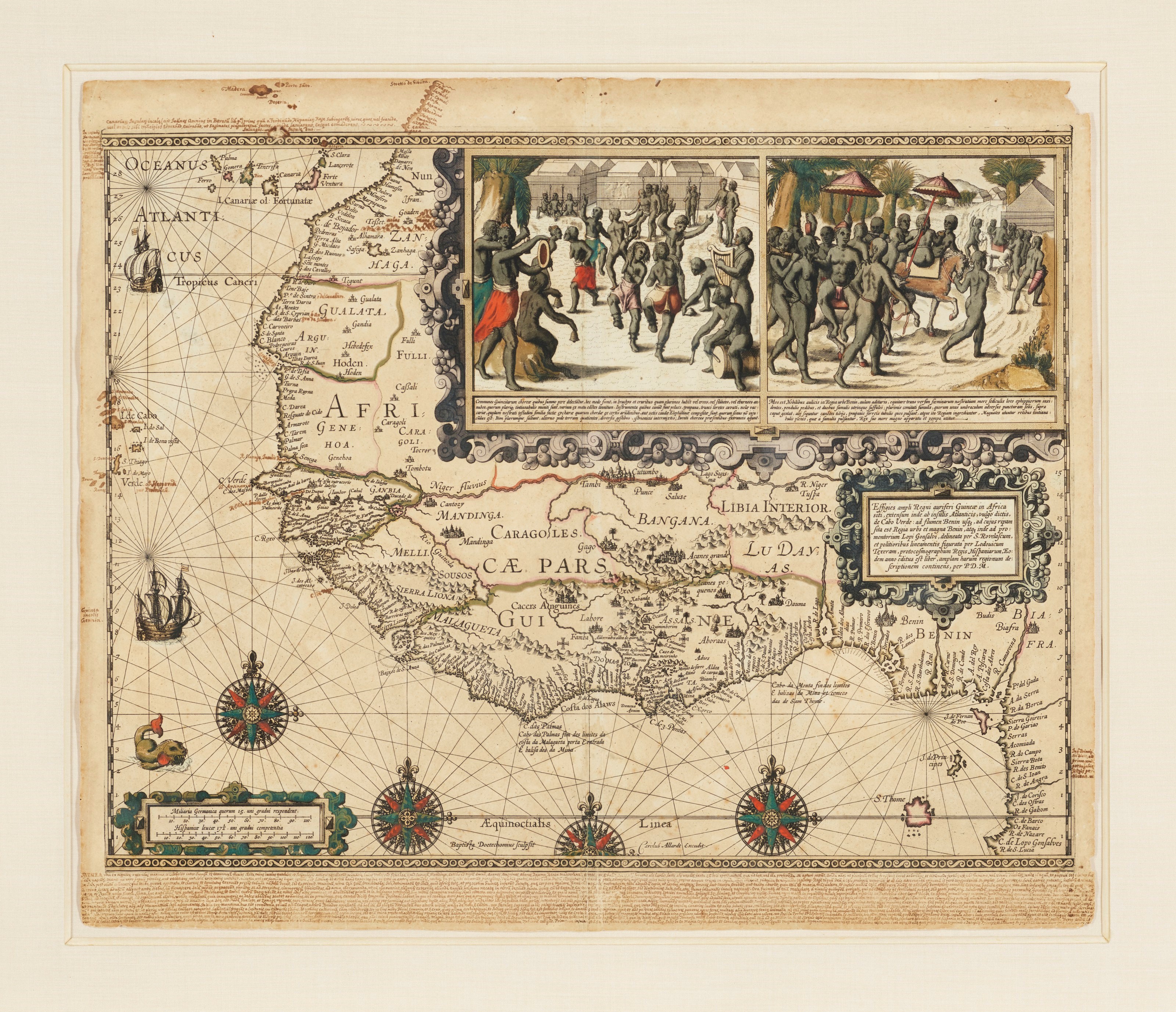
Highly decorative Golden Age Dutch map of West Africa, with old manuscript additions extending the northern border to Gibraltar and adding the islands of Madeira, and a long manuscript note in Latin regarding the Kingdom of Guinea. The title cartouche attributes this rare map to Luis Teixeira (1564-1604), the royal geographer of Spain, and to Francisco Revelasco; Baptista van Doetichum (1570-1611) was the engraver. About one-third of the map is occupied by rich period ornamentation and two vignettes depicting scenes from the Court of the King of Guinea. Schilder calls the map "one of the most beautiful products of the Dutch engraver's art from the years around 1600." It was originally created for Pieter de Marees' Beschrijvinge van Guinea (1602), although no known copy of the work contains it. All known examples of the map are reissues by Hugo Allard (1625-1691) or his son Carel, as here. Schilder, Monumenta Cartographica VII, 12.5.
Hand-colored engraved map, 604 x 461mm plate on a 632 x 529mm sheet (toned, some spotting, nicks and small loses to upper margin and upper right corner). Matted and framed. Provenance: extensive contemporary manuscript annotations.
Carel Allard, c.1690s
ALLARD, Carel (1648-1709). Effigies ampli regni auriferi Guineae in Africa siti, extensum inde ad insulis Atlanticis, vulgo dictis, de Cabo Verde. Amsterdam: C. Allard, [c.1690s.]
Highly decorative Golden Age Dutch map of West Africa, with old manuscript additions extending the northern border to Gibraltar and adding the islands of Madeira, and a long manuscript note in Latin regarding the Kingdom of Guinea. The title cartouche attributes this rare map to Luis Teixeira (1564-1604), the royal geographer of Spain, and to Francisco Revelasco; Baptista van Doetichum (1570-1611) was the engraver. About one-third of the map is occupied by rich period ornamentation and two vignettes depicting scenes from the Court of the King of Guinea. Schilder calls the map "one of the most beautiful products of the Dutch engraver's art from the years around 1600." It was originally created for Pieter de Marees' Beschrijvinge van Guinea (1602), although no known copy of the work contains it. All known examples of the map are reissues by Hugo Allard (1625-1691) or his son Carel, as here. Schilder, Monumenta Cartographica VII, 12.5.
Hand-colored engraved map, 604 x 461mm plate on a 632 x 529mm sheet (toned, some spotting, nicks and small loses to upper margin and upper right corner). Matted and framed. Provenance: extensive contemporary manuscript annotations.
Rare Map of West Africa
Carel Allard, c.1690s
ALLARD, Carel (1648-1709). Effigies ampli regni auriferi Guineae in Africa siti, extensum inde ad insulis Atlanticis, vulgo dictis, de Cabo Verde. Amsterdam: C. Allard, [c.1690s.]
Highly decorative Golden Age Dutch map of West Africa, with old manuscript additions extending the northern border to Gibraltar and adding the islands of Madeira, and a long manuscript note in Latin regarding the Kingdom of Guinea. The title cartouche attributes this rare map to Luis Teixeira (1564-1604), the royal geographer of Spain, and to Francisco Revelasco; Baptista van Doetichum (1570-1611) was the engraver. About one-third of the map is occupied by rich period ornamentation and two vignettes depicting scenes from the Court of the King of Guinea. Schilder calls the map "one of the most beautiful products of the Dutch engraver's art from the years around 1600." It was originally created for Pieter de Marees' Beschrijvinge van Guinea (1602), although no known copy of the work contains it. All known examples of the map are reissues by Hugo Allard (1625-1691) or his son Carel, as here. Schilder, Monumenta Cartographica VII, 12.5.
Hand-colored engraved map, 604 x 461mm plate on a 632 x 529mm sheet (toned, some spotting, nicks and small loses to upper margin and upper right corner). Matted and framed. Provenance: extensive contemporary manuscript annotations.
Carel Allard, c.1690s
ALLARD, Carel (1648-1709). Effigies ampli regni auriferi Guineae in Africa siti, extensum inde ad insulis Atlanticis, vulgo dictis, de Cabo Verde. Amsterdam: C. Allard, [c.1690s.]
Highly decorative Golden Age Dutch map of West Africa, with old manuscript additions extending the northern border to Gibraltar and adding the islands of Madeira, and a long manuscript note in Latin regarding the Kingdom of Guinea. The title cartouche attributes this rare map to Luis Teixeira (1564-1604), the royal geographer of Spain, and to Francisco Revelasco; Baptista van Doetichum (1570-1611) was the engraver. About one-third of the map is occupied by rich period ornamentation and two vignettes depicting scenes from the Court of the King of Guinea. Schilder calls the map "one of the most beautiful products of the Dutch engraver's art from the years around 1600." It was originally created for Pieter de Marees' Beschrijvinge van Guinea (1602), although no known copy of the work contains it. All known examples of the map are reissues by Hugo Allard (1625-1691) or his son Carel, as here. Schilder, Monumenta Cartographica VII, 12.5.
Hand-colored engraved map, 604 x 461mm plate on a 632 x 529mm sheet (toned, some spotting, nicks and small loses to upper margin and upper right corner). Matted and framed. Provenance: extensive contemporary manuscript annotations.